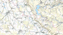
Territory data – spatial information download
Map application provides data for the purpose of urban planning authorities in accordance with law no. 283/2021 Coll. (building law). It allows authorized users to obtain free shp format data and to generate an electronically signed report.. According to Decree no. 500/2006 Coll. it regards: protected deposit area, protected area for special interventions into the earth's crust, mineral resources, abandoned mine lands, landslides and other geological risk areas and old mine workings impacts.

application
https://registry.geology.cz/id/VYDEJ_UAP-SDE-APL
Map
ISO 19119:
Spatial scope:
GEMET - INSPIRE themes, version 1.0:
CGS Geoscientific themes:
11.99,
48.253,
18.91,
51.247
creation: 2015-04-27, publication: 2016-02-29, revision: 2018-02-01
Provision of data on the territory pursuant to Section 64 of Act No. 283/2021 Coll. (Construction Act).
Ing. Martin Paleček
Leitnerova 204/22,
Brno,
602 00,
Česká republika
tel: +420543429261
email:
martin.palecek@geology.cz
Role: processor
RNDr. Renata Kachlíková
Kostelní 364/26,
Praha 7,
170 00,
Česká republika
tel: +420234742116
email:
renata.kachlikova@geology.cz
Role: point of contact
Klárov 131/3,
Praha 1,
118 00,
Česká republika
tel: +420257089411
email:
metadata@geology.cz
Role: custodian
Data Quality
Aplikace vytvořena ve WebAppBuilderu.
Constraints
jen autorizované osoby
Metadata about metadata
56c728d7-f310-43d1-b8e9-67bf0a010852
Mgr. Olga Moravcová, Ph.D.
Klárov 131/3,
Praha 1,
118 00,
Česká republika
tel: +420257089445
email:
olga.moravcova@geology.cz
Role: point of contact
2025-04-24

